Note from Elizabeth Cruz, Geographer/GIS Specialist at US Fish and Wildlife Service: “The reservoir locations shown on the maps are based on the dam crest and water surface elevations provided in the proposal by Premium Energy Holdings. In the case of Wittenberg and Woodland reservoirs, these maps match the maps in the proposal. Using the elevations given in the proposal, the Stony Clove map is quite different from the Premium Energy Holdings’ depiction. The reason for the discrepancy is unknown.“
Compare these maps to the maps from Premium Energy (further down this post).


Maps from the Premium Energy proposal PDF
(view PDF here)
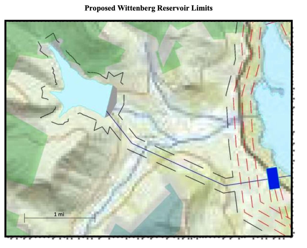
Map provided in Premium Energy’s proposal of Wittenberg / West Shokan proposed reservoir 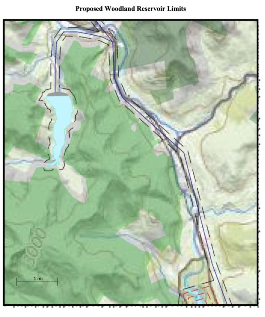
Map provided in Premium Energy’s proposal of Woodland valley proposed reservoir 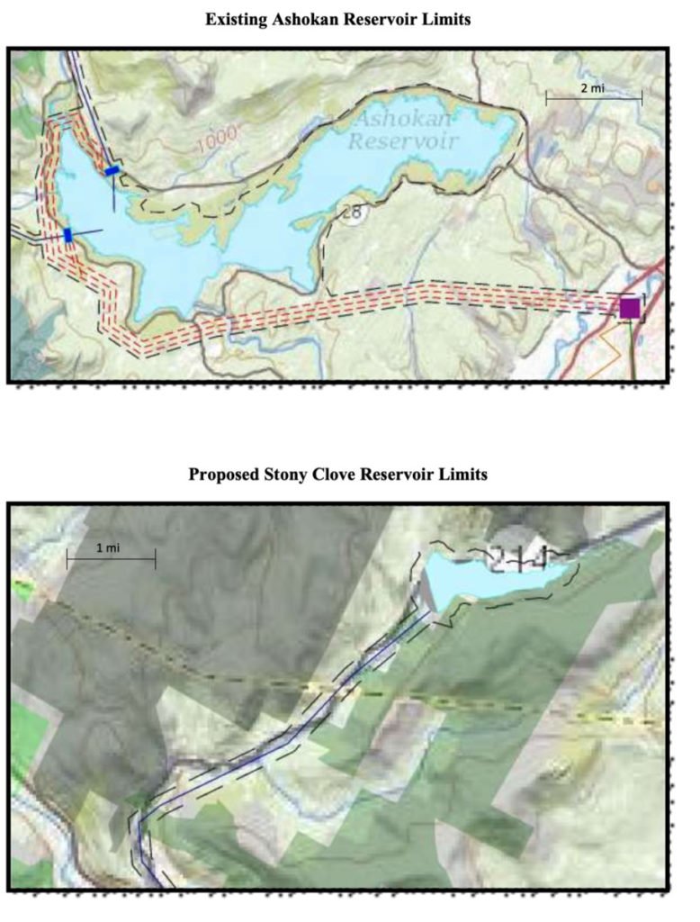
Map provided in Premium Energy’s proposal of Stony clove proposed reservoir and high tension electrical lines 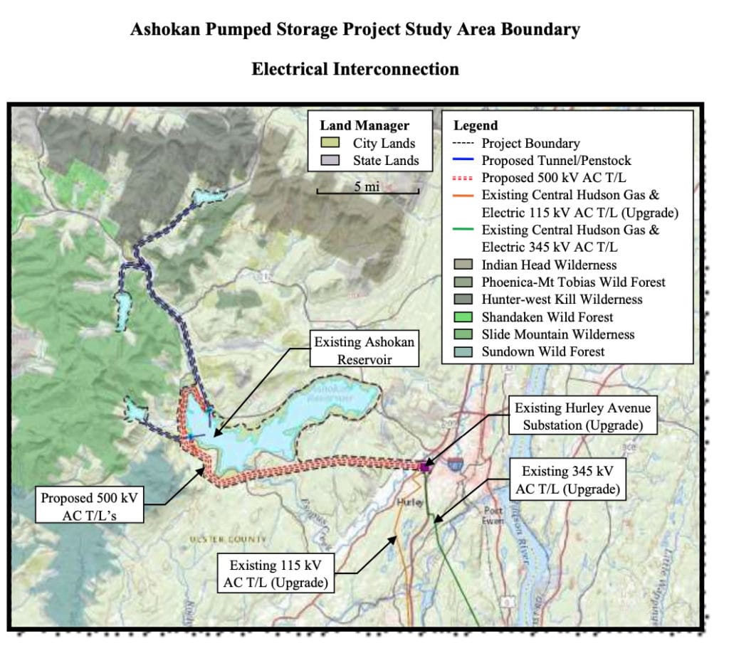
Map of three potential reservoirs from Premium Energy’s Proposal